Clipping the heightfield
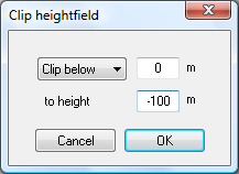
The clip heightfield window, shown below, allows you to set all terrain either above or below a certain height to another height value. To open this window, select the 'Operations→Heightfield→Clip heightfield' menu option.
This option was intended as a means to add artificial sea depth to real-world terrain maps that don't include bathymetry data.
