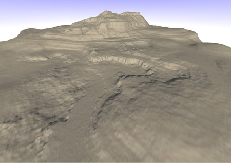
Cliffs and terracesThe terracing routine 'smooshes' (for lack of a better term) terrain up or down depending on its place within a certain altitude band. How far a height value is moved up or down is a function of a fractal line profile. The effect strength decays with radius from the centre of the terrace/cliff to keep things nice and smooth. Terraces and cliffs require fairly high detail to 'look right', so this routine is called after all inflation is done, when the heightfield has reached full resolution. Thankfully the terracing routine is quite fast, so there isn't a big CPU-time penalty.
Except where otherwise noted, content on this wiki is licensed under the following license:CC Attribution-Share Alike 3.0 Unported
|

