|
Table of Contents
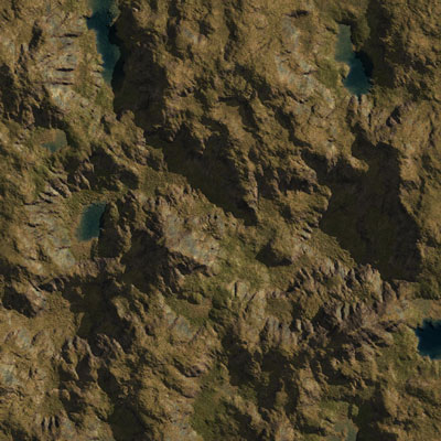
Texture mapping algorithmsOverview of textures in L3DTL3DT generates ground texture images, such as that shown below, by blending together a light map and a set of texture materials for each land type (e.g. grass, rock, snow). The distributions of land types are defined in the attributes map, which is in-turn calculated from the terrain slope, curvature, altitude, water-table depth, etc (see calculation details). The final texture for each land type is calculated from a 'material', which is a set of texture and bump-map images, plus a few blending parameters. The material for each land type are set in the land type editor on the 'appearance' pane.
Recent examples of L3DT textures rendered in 3D can be seen in the image gallery. High resolution texturesL3DT can generate massive unique textures (also known as megatextures) with up to 32×32 pixels per heightfield pixel, and a total texture size of up to 4M x 4M pixels. Automatic image-tiling for large maps is a standard feature for all supported image formats1), and all versions of L3DT. For information on using L3DT's texture mapping features, please refer to the texture mapping page in the user-guide. Texture anti-aliasing
Sorry, this section is incomplete.

Concealing texture-repeating artefacts
Sorry, this section is incomplete.

Texture rendering in Sapphire
Sorry, this section is incomplete.

1)
Currently supported image formats are bitmap, JPEG, PNG, TGA and DDS, and more can be added by plugins.
Except where otherwise noted, content on this wiki is licensed under the following license:CC Attribution-Share Alike 3.0 Unported
|

