| L3DT development blog |
|
| Large 3D terrain generator |
|
Table of Contents
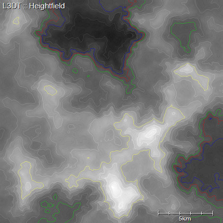
L3DT v2.3d release announcementDate: 27th of January 2006 Surprise! L3DT 2.3d is availableSome time late last night I made a few small but potentially rather useful additions to L3DT, so rather than hold back I thought I'd pop-out an unexpected and unscheduled update. If you're feeling impatient, you can find a brief list of changes on the release history page; otherwise, you may benefit from the somewhat more lengthy descriptions below. As usual, the installers are on their respective downloads pages. Heightfield previewI've added the 'Operations→Heightfield→Generate preview' option, which makes a quick low-detail version of the heightfield. It's 1/4th the resolution, around 4× faster, but still looks pretty-much the same (compare regular and preview). The idea is that this feature will make it easier to iteratively design a heightfield, as you can rapidly (and semi-reliably) assess the impact of your changes on the final heightfield. There is likely to be much tweaking and re-jigging of this feature in the next few releases, so please feel free to send your feedback my way (preferrably via the users' forum). File format stuff Though had previously avowed not to add any more file format support to L3DT until I had finished the software development kit, I've acquiesced to popular demands and made the following additions:
'Duplicate tile borders' - What's that?I've added the somewhat cryptic 'Operations→Active map→Duplicate tile borders' option, which fixes a relatively undocumented problem with 3D-renderers when handling tiled data. To cut a long story short, it re-packs each mosaic tile with one extra row and column of data from the neighbouring tiles, so that the eastern-most pixel in one tile is the same as the western-most pixel in the next tile to the east, and likewise for the north/south axis. This is required by some implementations of tiled renderers, though not L3DTVi2. Nor is it required for L3DT, and so it's not a default mode. More documentation will follow at a later date. Bug-fixesThere was a bug in the file preferences dialog box, only when accessed through the export wizard, that meant that your settings weren't being applied properly. This has been fixed. Website stuffThe users' gallery is back up and running again, following a little blunder in which an upgrade of the community forum broke the gallery login. Please feel free to drop-by and cop a squizz of the latest offerings. I've also gone to town adding content to the useful links page of the users' wiki. There are lots of links to terrain software, programming resources, data resource sites, and other handy miscellany. If you think I've missed something, please feel free to login and add it yourself. Also in the wiki; I've started a page for users' tips and tricks, where everyone may jot down little bits of wisdom they've gained vis-a-vis using L3DT. There's nothing much there yet, but I hope that will change shortly (wink wink). Comments, questions, suggestions?Comments, questions and suggestions regarding this release are welcome on the users' forum. Except where otherwise noted, content on this wiki is licensed under the following license:CC Attribution-Share Alike 3.0 Unported
|