Heightfield issue and problem
Hello,
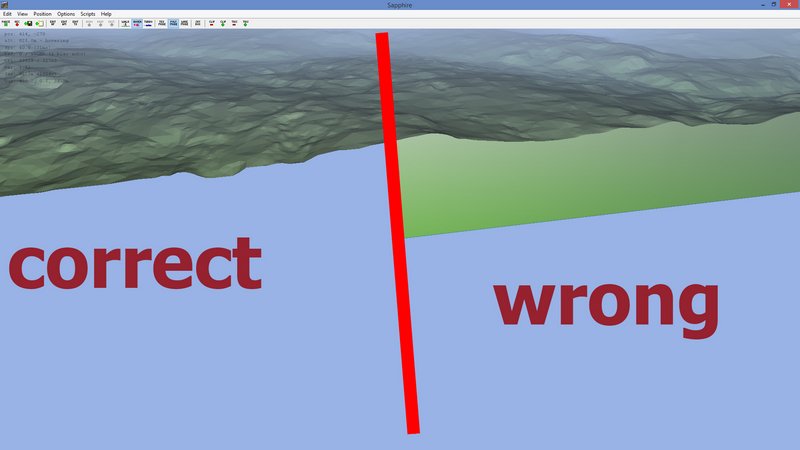
I´ve got a Problem that makes me mad. To explain what excatly the Problem is, please see these screenshots first.
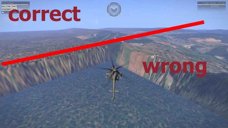
ingame it looks like this:
and
So, now the steps about how I got the heightfield andso on.
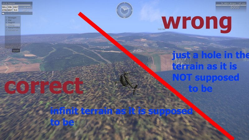
I have grabbed the terrain via using http://earthexplorer.usgs.gov/ and converting the Astra DEM files by using another tool, the result then was a very good terrainfield. What I have not seen is that the edges of the field are in somewhat not equal to each other everywhere. Pretty much more than the half of the terrain has a wrapped edge instead of an open end edge so that the game can render an infinite terrain like one can see in the both ingame above.
I´d like to know, how can I avoid this and also how can I fix this if this happen?
Thanks a lot and regards
Memphis
I´ve got a Problem that makes me mad. To explain what excatly the Problem is, please see these screenshots first.
ingame it looks like this:
and
So, now the steps about how I got the heightfield andso on.
I have grabbed the terrain via using http://earthexplorer.usgs.gov/ and converting the Astra DEM files by using another tool, the result then was a very good terrainfield. What I have not seen is that the edges of the field are in somewhat not equal to each other everywhere. Pretty much more than the half of the terrain has a wrapped edge instead of an open end edge so that the game can render an infinite terrain like one can see in the both ingame above.
I´d like to know, how can I avoid this and also how can I fix this if this happen?
Thanks a lot and regards
Memphis