Exporting to OpenSim
I've been using LT3D to make terrains for my stand-alone OpenSimulator(OS) grid, which I will be using for "shoots" in a webcomic I make.
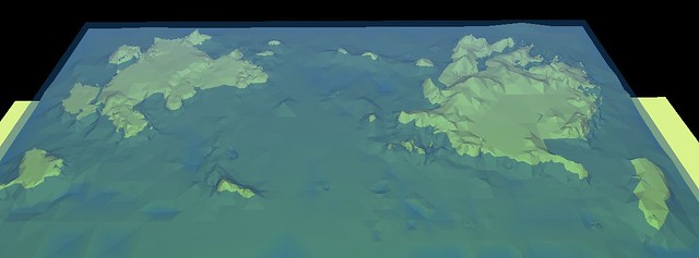 Buggle Islands overview
The sims (individual square sections of the grid) are not 256x256 m as they are in the default, but 768x768 instead, as I wanted to have a large area within which to create permanent sets to shoot the webcomic in.
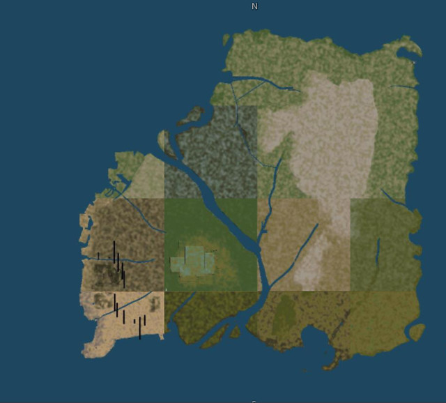
4x4 sim or 3072x3072m map of Urbania
Of course OS, which is the open source version of Second Life(SL), has its own methods of generating terrain cover (you get four zones/textures per sim, with coverage based on height), so really I'm using LT3D to sculpt the heightfield. I think I've got the basics right. The horizontal scale is 1m but I suspect I'm getting mixed up abbout both sea levels and the vertical scale. In OpenSimulator the default water level is 20m, and I know I can set this the same in LT3D, but when I import a heightfield I've exported from LT3D it always seems magnified in height!
I'm clearly missing something obvious here, but what? I'd rather have what I see in LT3D match up in OpenSimulator. The two formats I can export with for OS are r32 and PNG. Does it make a difference if I use one over the other? Is there a setting I'm missing in LT3D related to height scale?
The other thing is that I can do "post-import modifications" in OS. The console has the following commands...
...so if I knew why the heightmap was multiplied and how much, I could adjust it back to what I want it to be by a number of steps, but I need to know how to judge that.
Suggestions please.
UPDATE: I think I will do some tests on dummy terrains created in OS and imported to LT3D, and then exported back into OS, and post the results here. It makes sense to show what I mean by "magnified" in detail. Will post that this afternoon.
Buggle Islands overview The sims (individual square sections of the grid) are not 256x256 m as they are in the default, but 768x768 instead, as I wanted to have a large area within which to create permanent sets to shoot the webcomic in.
4x4 sim or 3072x3072m map of Urbania
Of course OS, which is the open source version of Second Life(SL), has its own methods of generating terrain cover (you get four zones/textures per sim, with coverage based on height), so really I'm using LT3D to sculpt the heightfield. I think I've got the basics right. The horizontal scale is 1m but I suspect I'm getting mixed up abbout both sea levels and the vertical scale. In OpenSimulator the default water level is 20m, and I know I can set this the same in LT3D, but when I import a heightfield I've exported from LT3D it always seems magnified in height!
I'm clearly missing something obvious here, but what? I'd rather have what I see in LT3D match up in OpenSimulator. The two formats I can export with for OS are r32 and PNG. Does it make a difference if I use one over the other? Is there a setting I'm missing in LT3D related to height scale?
The other thing is that I can do "post-import modifications" in OS. The console has the following commands...
- Code: Select all
terrain elevate x   - raises the terrain in the sim by x metres
terrain lower x     - lowers the terrain in the sim by x metres
terrain multiply x  - multiplies the terrain values by x
...so if I knew why the heightmap was multiplied and how much, I could adjust it back to what I want it to be by a number of steps, but I need to know how to judge that.
Suggestions please.
UPDATE: I think I will do some tests on dummy terrains created in OS and imported to LT3D, and then exported back into OS, and post the results here. It makes sense to show what I mean by "magnified" in detail. Will post that this afternoon.


