L3DT documentation
Large 3D terrain generator

Import custom map layers

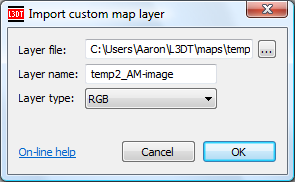
You can import new map layers into your L3DT project using the 'File→Import→New map layer…' menu option. This will open the import custom map layer window, shown below:

The import custom map layer dialog.

The options are:

File name The file name of the map file to be imported. You may import both single map files (e.g. BMP, JPG, TER, etc), or mosaic files (MMF). You can use the '…' button to pick the file using a 'file open' window.
Layer name The abbreviated name used to store or access the map layer in L3DT. Typically this can be a short token, like “mymap”, but please note that some names are reserved (see below). Also, the name cannot include certain reserved characters such as .<>/\ (etc).
Layer type The type of the map to be imported (see notes below).

If you use the file browse button to select a MMF or ZMAP file, the layer name and layer type values will be automatically filled-out using the values stored in the files

When you click OK, L3DT will check your inputs, and if that's all OK, it will then attempt to open the map file. If any problems are encountered, you should get an error message telling you the nature of the problem.

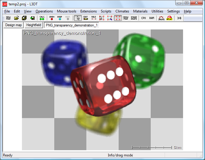
If the import succeeds, L3DT will then display your map layer in the main window, e.g:

An example of an imported custom map layer.

Reserved map names

Please note that the following map names are reserved for map layers in L3DT's project:

Map name What is it?
DM The design map.
HF The heightfield.
WM The water map.
WS The salinity map.
TN The normals map.
SH The shadow map.
LM The light map.
TX The texture map.
Alpha_X The alpha map(s), where X = 1, 2, etc.

If you use any of the above map names for your imported map layer, you will overwrite the existing map layer in the project. If that's what you want to do, then OK, but if not, then don't.

Supported map types

Supported map types are:

Map type What is it?
8-bit integer Used for 8-bit greyscale images and masks.
16-bit integer Used for arbitrary 16-bit data maps.
32-bit integer Used for arbitrary 32-bit data maps.
RGB colour Used for true-colour images (24-bit).
RGBA colour Used for 32-bit RGBA images.
Heightfield 32-bit floating point maps, normally used for heightfields and the like.
Design map Used for design maps.
Water map Used for water maps.
Normal map Used for 24-bit normal map / bump-map images.
Attributes map Used for attribute maps.
 
l3dt/userguide/io/import/custom.txt · Last modified: 2017/08/31 06:35 (external edit)
 
Except where otherwise noted, content on this wiki is licensed under the following license:CC Attribution-Share Alike 3.0 Unported
Recent changes RSS feed Donate Powered by PHP Valid XHTML 1.0 Valid CSS Driven by DokuWiki