The latest developmental build of L3DT (v2.7 build 6) includes partial support for the GeoTIFF file format. The new TIF plugin included in the latest build can read heightfields from 8/16/24/32-bit TIFF files, and supports a limited subset of the GeoTIFF georeferencing tags, including tiepoints, geographic scaling and extents (lat/lon only), EPSG datum and projection codes. The plugin does not implement the entirety of the GeoTIFF standard, but this may be added in the future if required/desired.
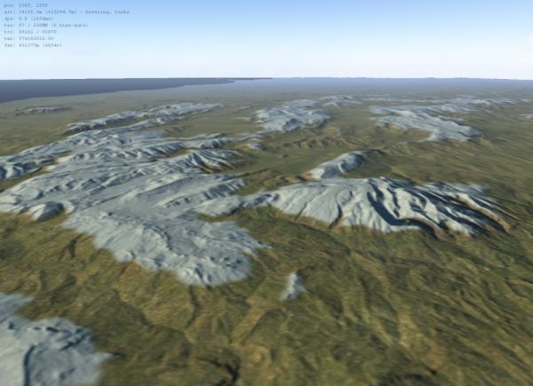
As an example of the usefulness of this plugin, please have a look at the new Loading 'Shuttle Radar Topography Mission' maps in L3DT tutorial, which explains how to import real-world terrain heightmaps into L3DT using the CGIAR GeoTIFF download site. Here's a pic of the results in L3DT (this is central Italy, looking north-west):
Please note that the 'atGeoRef2' and 'L3DTio_HFZ' plugins have also been updated in this build to include additional georeferencing support to match that of the TIFF plugin; in particular, EPSG projection codes.
Cheerio,
Aaron.
