I've been using L3DT very extensively for the last few weeks, and I've noticed a couple of bugs, and a couple of places where my workflow is getting stuck in a bottleneck.
The first is that when iterating the watermap calculation, rarely the Salinity map will disappear from the project tabs. This has happened to me about 3 times on 12.03 Pro dev build 3. No error messages, or anything, and I cannot regenerate a Salinity map after this happens.
So I've just gone to a non-salinity influenced template for my custom climate (based on Temperate instead of Temperate Coastal).
Second, I've been studying GRASS opensource GIS, and reading a lot of the modern computer cartography techniques. So I have a much better understanding of how you are using Gradient and Curvature in the Climate modeling now. What I'm having problems with (and it's partially the scale of my heighfield) is getting a satisfactory result from the Watermap and the Water coefficient of the Attribute calculation.
I think the docs could use a little bit more information on that side.
The other bug I've run into with the water map is a popup I get when I try to delete a waterbody that reads, "Error: waterbody cannot be deleted because it is not found in the water body list. This is probably Aaron's fault."
I'm working with a heightfield that has a vertical range of -900m -> 5468m, and was 700m per pixel. I've scaled that down to 140m/px to simulate a 5times vertical exaggeration. I've also generated a pit/sink map with the help of GRASS, and an by using that as a texture-overlay I can place small bodies of water, especially along the jungles and forest valley areas away from large water-bodies. As such, I have, well.. lots and lots of small waterbodies. This may have triggered the bugs.
Also, while editing the watermap, I often lose the elevation value shown in the bottom right even if "show HF in watermap" or " HF overlay in view" for the edit water map tool are checked.
As such, my current workflow is to sample a point on the watermap with the arrow tool where I see a sink on my Sinkmap Texture Overlay (to get the HF elevation), do a quick fuzzy add of a couple of meters (or less than one sometimes) to that elevation in my head, go to the Water Flood Tool, type in the value, and then go back to the map to "guess" where I clicked the first time to trigger the flood. On sinks in very low Gradient terrain or when working at a generalized (zoomed out) view, this can be frustrating as each missed click (where the terrain is above my input water-height value) gives a pop-up error and a sound effect.
I would love a tool or flag for the water map edit tool that would allow me to flood "at current heighfield elevation +Z.offset" (where Z offset can be a range, so <1m if I'm finding shorelines, or >1m if I'm flooding from the bottom of a sink). This would combine well with the overflow test, and help quicken watermap iterations.
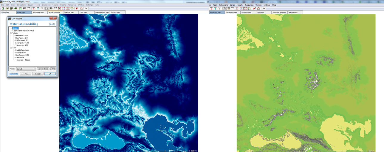
Example screenshot showing a current iteration of the watermap + attribute map: