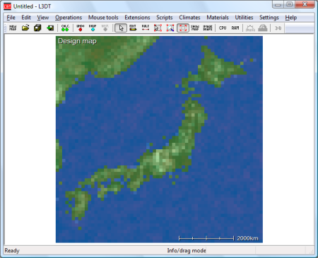
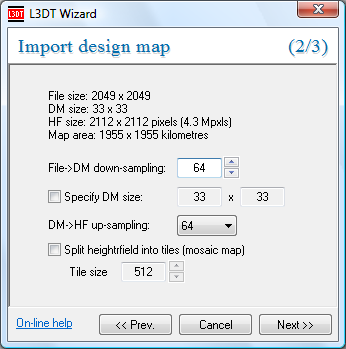
Importing a design mapL3DT can import the altitude layer of the design map from binary terrain formats or image files. For example, the design map for Japan (and selected parts of Korea and/or China and/or Russia) is shown below. This design map was imported from a VTP binary terrain file (.bt). To import a design map, select the 'File→Import→Design map…' option from the menu. The first part of the import process is the same as for importing a heightfield, so you are recommended to read that part of the user-guide before proceeding. After the file has been imported, you will be passed through to the Import design map wizard, shown below. The options are as follows:
After clicking on the Next » wizard button, you will be asked to input some of the design map parameters such as climate and lake coverage (etc) via the design map parameters wizard pane. Except where otherwise noted, content on this wiki is licensed under the following license:CC Attribution-Share Alike 3.0 Unported
|


