I'm just wondering what everyone's experience is with using L3DT Pro in the various game engines available. I'm mostly concerned with the "indie" engines like Torque, Torque Advanced, Realm Crafter, etc. Can anyone share their experiences with trying to render out their high-res maps in game and what kind of results they got?
MY main curiousity is whether or not the large terrain map size causes large load times or any other rendering issues. Thanks!
-Brihtwulf
| L3DT users' community |
|
| Large 3D terrain generator |
Ability to render maps from Pro version in engines?
18 posts
• Page 1 of 2 • 1, 2
Ability to render maps from Pro version in engines?
Right now where running the 4096 X 4096 map for the TGEA Engine, Are Horiz Scale set to 10 to allow the 41x41 kilometer area.
This allows us a huge map and easy to make changes on the fly and see them with in a hour. We have render are map at full resolution and that took over 28hrs or less to do. The results of the render were impressive for us and very happy with L3DT as main terrain software. From the mad cows desk to yours,
Peace Madcowthomas Yo...Reggie vacation mom! "Without imagination we would cease to exist" William Thomas (1970-) Warning! Burping Babies are the Cause of Global Warming!
Do you have any screenshots of the results within your client or even the TGEA editor? I am interested to see what the high-res textures look like once applied, especially over a large area.
-Brihtwulf
@Madcowthomas
Sorry to hijack the thread :S What res. textures/lightmaps/ etc. do you use? Thanks for looking
I posted 2 screen shots on the Gallery
Low Res 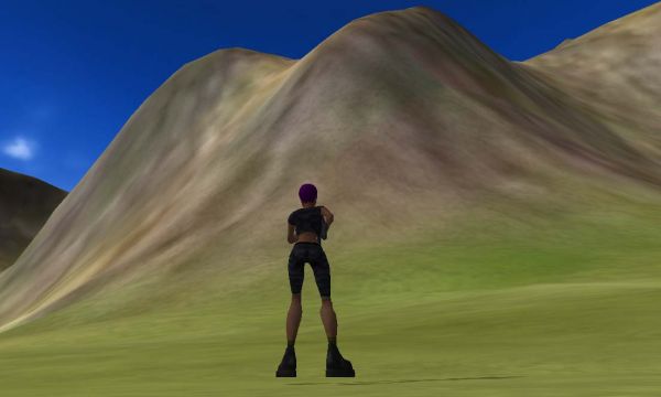
High Res 32k 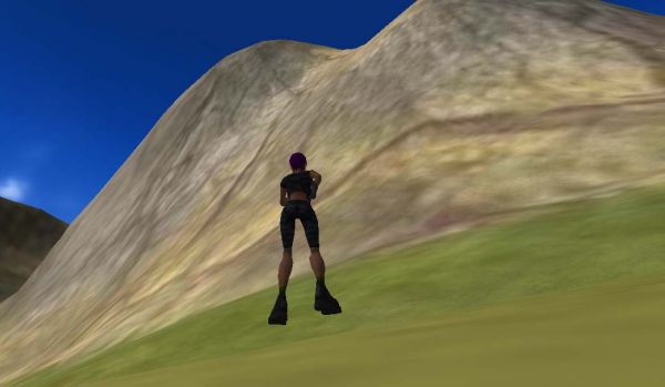
Brihtwulf Shots look more impressive in game, but in the end were still impressed. I ran Sapphire and TGEA at the same time. I have 2 monitors here that the same brand and compared the 2 side by side. Comparing them we see slight changes, but thats me was going to the extreme picky side. One on my partners could not see the different but was blow away but the details and preformace. Hi metalliandy Here is the summary of the project ran in 32k, will this be help? But all are maps are run in lowest setting most the time to allow changes on the fly. L3DT map summary for 'planet5' Map project file: planet5.proj Project directory: F:\Terrain Backups\Planet5_32kmap Terrain size: 4096 × 4096 Texture size: 32768 × 32768 Contents of map project * Maps o Design map o Heightfield o Water map o Salinity map o Attributes map o Terrain normals o Light map o Texture map * Settings and flags o Operations o Design map settings o Heightfield settings o Attributes map settings o Terrain normals settings o Light map settings o Texture map settings Maps Design map Map size: 64 × 64 Horiz. scale: 640.00m Map file: planet5_DM.dmf File type: L3DT Design Map File Heightfield Map size: 4096 × 4096 Horiz. scale: 10.00m Map file: HF\planet5_HF.mmf File type: 8 × 8 mosaic of 5122 pixel Heightfield File v2 + gzips (.hfz) Mosaic files: Water map Map size: 4096 × 4096 Horiz. scale: 10.00m Map file: WM\planet5_WM.mmf File type: 8 × 8 mosaic of 5122 pixel L3DT Water Map Files (.wmf) Mosaic files: Salinity map Map size: 4096 × 4096 Horiz. scale: 10.00m Map file: WS\planet5_WS.mmf File type: 8 × 8 mosaic of 5122 pixel Heightfield File v2 + gzips (.hfz) Mosaic files: Attributes map Map size: 16384 × 16384 Horiz. scale: 2.50m Map file: AM\planet5_AM.mmf File type: 32 × 32 mosaic of 5122 pixel L3DT Attributes Map File + GZIPs (.amf.gz) Mosaic files: Terrain normals Map size: 16384 × 16384 Horiz. scale: 2.50m Map file: TN\planet5_TN.mmf File type: 32 × 32 mosaic of 5122 pixel PNG images (.png) Mosaic files: Light map Map size: 32768 × 32768 Horiz. scale: 1.25m Map file: LM\planet5_LM.mmf File type: 64 × 64 mosaic of 5122 pixel JPEG images (.jpg) Mosaic files: Texture map Map size: 32768 × 32768 Horiz. scale: 1.25m Map file: TX\planet5_TX.mmf File type: 64 × 64 mosaic of 5122 pixel JPEG images (.jpg) Mosaic files: Settings and flags * Operations o GenDM o GenHF o FloodAll o GenTN o FloodSea o FloodLakes o WaterTable o GenAM o GenLM o GenTX * Design map settings o Algorithm = "PeakDM" o nx = 64 o ny = 64 o SeaLand = 55 o FlatSteep = 50 o FeatureScale = 50 o FracRough = 50 o PeakRough = 50 o Cliffs = 50 o Erosion = 5 o Lakes = 25 o Climate = "Temperate" * Heightfield settings o Algorithm = "InflateDM64" o HorizScale = 10.000000 o MosaicFlag = true o MosaicSize = 512 * Attributes map settings o Climate = "Temperate" * Terrain normals settings o BumpMapping = false o TN_in_HF = 4 o MosaicFlag = true o MosaicSize = 512 * Light map settings o Sun(r,g,b) = { 255, 238, 206 } o Amb(r,g,b) = { 230, 245, 255 } o Azim = 0.000000 o Elev = 45.000000 o Brightness = 1.000000 o SunAmbRatio = 0.750000 o UseWM = false o ShadowFlag = false o BumpMapping = false o MosaicFlag = true o MosaicSize = 512 o LM_in_HF = 8 * Texture map settings o UseLM = true o UseTX = true o UseStrata = true o TX_in_HF = 8 o MosaicFlag = true o MosaicSize = 512 o MaxRadAA = 8 From the mad cows desk to yours,
Peace Madcowthomas Yo...Reggie vacation mom! "Without imagination we would cease to exist" William Thomas (1970-) Warning! Burping Babies are the Cause of Global Warming!
The hi-res screen isn't bad, even for being put into a jpeg. How are you able to render this in your game environment? I wasn't aware that TGE could load the terrain texture maps on-the-fly. Of course you HAVE to make them a mosaic map, as 32k x 32k is just an impossible texture to load into memory.
Can you just give TGE or TGEA the heightmap and mosaic files and have it render out the map seamlessly? Or, is that part of the "Atlas" export process? I have to say I'm not completely familiar with all the workings of Torque. I've previously considered it to be mostly a FPS engine. Are there other engines that are compatable with the maps generated by L3DT Pro? -Brihtwulf
Hey guys,
@Madcowthomas Thanks for the info How long did it take you to render you map?...i am going a similar route but with a 0.1-0.5 Horiz scale. will prob take a whole week..lol @Brihtwulf TGEA can use "legacy" terrain and Atlas. With legacy you can load a 256x2 hight map and it will render it for you. Atlas on the other hand needs to be pre-rendered into a file (.atlas) and than the terrain geometry is paged and sent to the end-user when needed. With Atlas you can create vast maps with (comparatively) little load @ Run time. The downside is that you cant change the geometry once rendered. Any changes need to be done in an external app (L3DT Im not sure which engines are supported by L3DT (apart from spring)but you can export a RAW file which can be converted into a compatible HM format by many engines. Hope that helps
Hi everyone,
That map took about 28hrs I have to say. Run on my shuttle computer which is not really much. That computer was actually recording 2 of my TV shows as L3DT processed the map. Some the computer spec's Windows Windows XP5.1 (Build 2600) Service Pack 2 CPU Intel(R) Pentium CPU 3.00GHz RAM 1.00 GB Display Adapters Intel built in Screen Resolution 1280 X 1024 - 32 bit metalliandy for kicks try a 4096x4096 with a 10 Horz scale , that be the 41x41 kilometer and just do a render with min settings. I average about a 1 to 1.5 hours to render. Last edited by Madcowthomas on Sun Dec 09, 2007 8:57 pm, edited 1 time in total.
From the mad cows desk to yours,
Peace Madcowthomas Yo...Reggie vacation mom! "Without imagination we would cease to exist" William Thomas (1970-) Warning! Burping Babies are the Cause of Global Warming!
Hey Madcowthomas,
I will have a go at the settings you suggested. For the benchmark map, did you mean with high res textures or set the 64x64 design map and click through without changing everything else? I wonder if there is a way for users to take a small file that holds the map information that could be loaded by other users, without the need for manually inputting information, so they can compare render times. Maybe Aaron would have room on the site for a benchmark log similar to http://www.eofw.org/bench/ I shall make a suggestion in the feature requests. OBTW did you overclock your cpu? fast fast fast! Thanks for looking
Hey Metalliandy,
Never over clock any pc yet in my life, i just go buy a new one. lol That cpu was not suppose to be there, forgot to remove it. What happen copied my stat from main computer and removing what not needed and change the info to the other computer. Sorry for any misunderstandings From the mad cows desk to yours,
Peace Madcowthomas Yo...Reggie vacation mom! "Without imagination we would cease to exist" William Thomas (1970-) Warning! Burping Babies are the Cause of Global Warming!
Hi Brihtwulf,
Any 3D engine that supports paged loading should not have trouble with the map sizes produced by L3DT Pro, and should not have worse load times. In particular, engines like TGEA (with Atlas), Ogre3D (with PLSM) and Multiverse should be file with large map sizes, but others may need more modification. Anyway, I can't offer you much in the way of my personal experiences with using other game engines, but several forum users have previously demonstrated the use of L3DT Pro maps in various game engines, and perhaps they could tell you more of their experiences. Firstly, JohnJ using Ogre3d: 
blackFin using GLScene: 
(the old 3D render for L3DT, 'L3DTVi2', was also written in GLScene) Here's Demi using Crystal Space 3D: 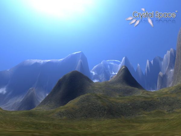
Of course, there are numerous users of TGEA and Spring on the forum who could add their insights also (and some have; thanks Madcowthomas and Metalliandy). I hope this helps. Cheerio, Aaron.
Hey Brihtwulf,
Actually TGEA is a very versatile engine and Minions of Mirth http://www.prairiegames.com/ is a very popular mmorpg made with TGE (with a TGEA update in the works). It currently has more than 50,000 registered users You can download the tech. they use for free, under a modified BSD licence, as long as you have TGE and the Arcane effects pack. http://www.mmoworkshop.com/trac/mom/wiki/FAQ Powerful stuff Hope that helps
Well, the only problem I have with that is that when I tried out the MoM game, I didn't really care for it. It has some real issues with things like delayed animation and rubber-banding. I also didn't like the mechanics/features very much and it would take a lot of code modification to get it reworked. I looked into the MMO Kit they have, and it was rather overly complicated. It required about 10+ lines of code to spawn ONE mob. It's not that I'm looking for everything to be done for me, but I would prefer a solution that didn't involve me going through all their code, rewriting a lot of it, and then coding in my content and mechanics from scratch.
I wouldn't mind 3D Game Studio if it had better networking and MMO features, Visual3D.NET is still far from being complete, and RealmCrafter still isn't ready with DirectX9. Most other game engines either have little or NO networking support at all (TV3D). Everything else (BigWorld, Unreal) just isn't viable for an indie company project. I am quite open to other suggestions though! -Brihtwulf
Brihtwulf
We stop using the MMO kits, we found there a lot of bad code and ect. We started with a fresh engine TGEA 1.03 and add one piece at a time and are getting good results. Truth is want a good networking engine for a low price TGEA is the best at this time or until drop 50k or more down on a engine. From the mad cows desk to yours,
Peace Madcowthomas Yo...Reggie vacation mom! "Without imagination we would cease to exist" William Thomas (1970-) Warning! Burping Babies are the Cause of Global Warming!
18 posts
• Page 1 of 2 • 1, 2
Who is onlineUsers browsing this forum: No registered users and 65 guests |

