|
Table of Contents
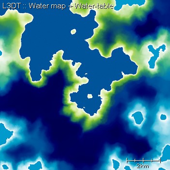
The water mapThe water map is a map of water levels and types. This structure, while large in memory, allow us to generate water bodies at different levels (ie. lakes) and non-flat water bodies such as rivers. Example mapHere solid dark blue is sea, solid light blue are lakes, white pixels are water edges, and the spooky looking stuff is the water table (aqua around freshwater, green around sea water, deep blue when far underground). Further reading
Except where otherwise noted, content on this wiki is licensed under the following license:CC Attribution-Share Alike 3.0 Unported
|

