|
Table of Contents
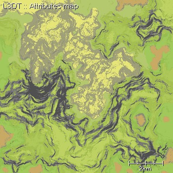
The attributes mapThe attributes map describes the type of land in each pixel of the texture map or alpha maps (e.g. rocks, sand, grassland, jungle, etc). The attributes map is conceptually similar to a set of alpha maps, but it takes less space. Instead of each land type having its own image (or layer in an image), it is assigned a unique 16-bit value that is stored in the attributes map. For a typical map with four land types, the attributes map takes 1/2 the space in memory than an equivalent alpha map. For a more complex map with 8 land types, it is 1/4th. The 16-bit attributes map pixels are comprised:
The land types in the attributes map are defined in climates, which can be viewed/edited using the climate manager / editor. The climate definition also specifies the display colours for each land type (see example below), so if you don't like the colour scheme you can change it. Note water type is stored in a separate water map. Example mapFurther reading
Except where otherwise noted, content on this wiki is licensed under the following license:CC Attribution-Share Alike 3.0 Unported
|

